Taylor & Skinner’s Survey and Maps of the Roads of North Britain, or Scotland.

  • Taylor, George
  • London: Publish'd for the Authors 1776
  • ESTC N63223.

£500

Enquire

Description

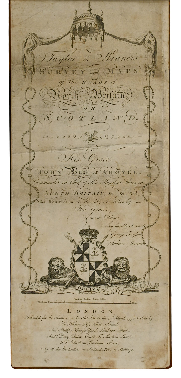
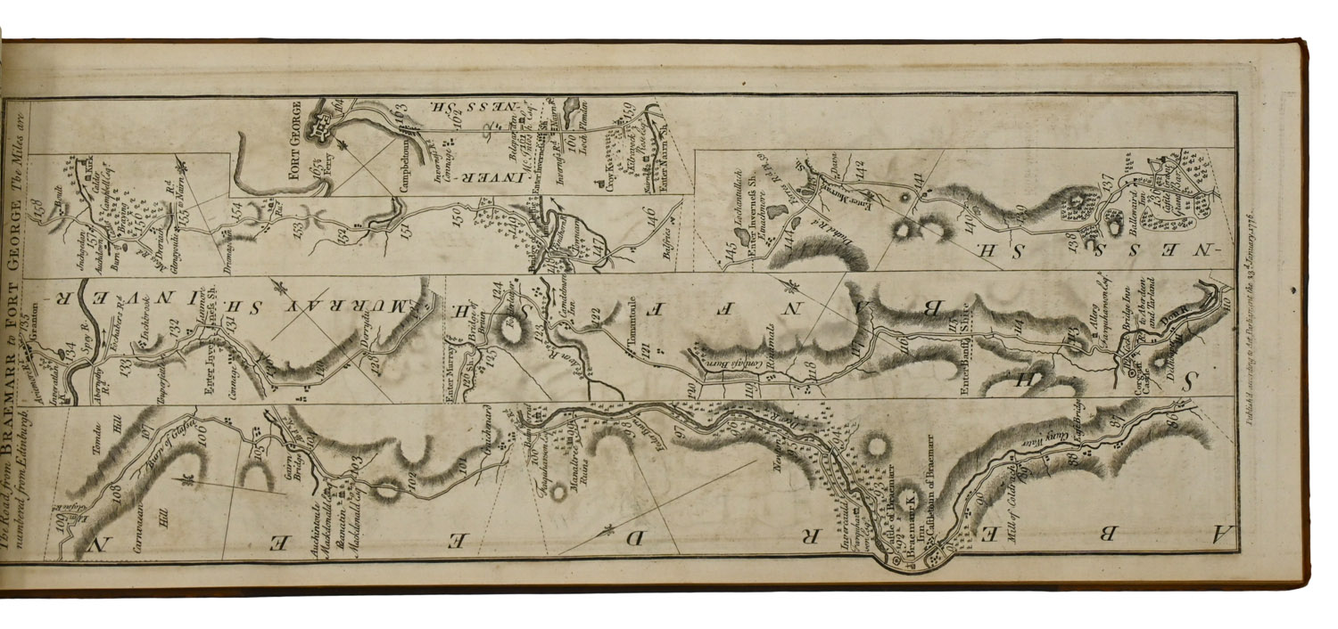
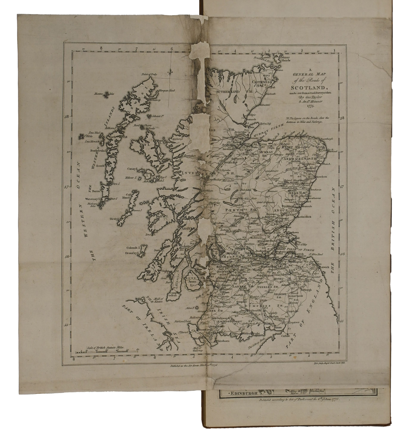
FIRST EDITION, obling slim folio, comprising engraved title-page, letterpress index leaf, double-page folding map, and 61 engraved strip maps on 31 sheets. Old half calf, spine lettered in gilt, marbled endpapers. Title-page foxed and soiled, showing old creases, folding map worn at fold and laid down with some areas of loss around fold, otherwise just some spotting and foxing. Binding marked and scratched, extremities rubbed and a bit worn.

Notes

The first edition of the first road atlas of Scotland, showing strip maps at a one-inch to one-mile scale. Those originally intended for use would have been folded to fit in a saddlebag and had a limp binding to enable that. This copy has been flattened out and bound like a regular (albeit awkwardly shaped) book for consultation in a study instead of on horseback.

Location & Opening Times

3a & 4a Haddington Place, Edinburgh, EH7 4AE


Opening Hours

Open seven days a week, 11am - 5pm

On Thursdays late night opening until 8pm